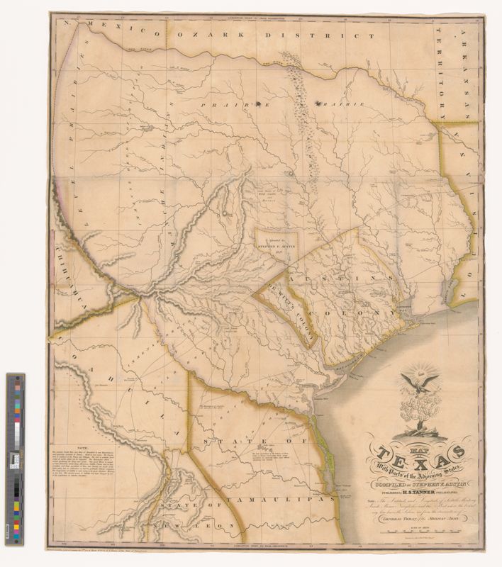
Stephen F. Austin’s 1830 Map of Texas
This first edition of Stephen F. Austin’s 1830 Map of Texas is often described as “the first meaningful map of Texas” and was the first to accurately depict the rivers in Texas and illustrate many of the early settlements including Brazoria, Gonzales, Harrisburg, Matagorda, Victoria and Waco Village.
This map was published in eight editions through 1845 and is the first map of Texas printed in the United States. The map was produced as part of a land grant agreement with the Mexican government but it was also intended to be a showcase for new settlers to Texas. Therefore, it was made to be as open and as inviting as possible.
This map was acquired through the generosity of several donors including a lead gift by The Texas A&M System Chancellor John Sharp ’72, members of the Board of Regents, and Bonnie and Otway Denny ’71.