Search Results
Select an image to start the slideshow
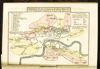
Plan of the General Cemetery at Kensal Green in the Harrow Road
1 of 11
Philips' A.B.C. pocket atlas-guide to London, with new postal areas
2 of 11
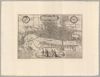
Plan of part of the city of Westminster, copied from Radulphus Aggas's [sic] map, taken in the reign of Queen Elizabeth 1578
3 of 11

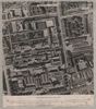
Norden's maps of London and Westminster
4 of 11
Illustrations of the public buildings of London; with historical and descriptive accounts of each edifice
5 of 11
Cary's survey of the high roads from London to Hampton Court . . .
6 of 11
Hoefnagel's plan of London from Braun and Hogenburg's Civitates orbis terrarum, 1572
7 of 11
Seven unpublished drawings
8 of 11
Greater London : air photo mosaics
9 of 11

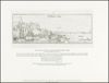
A view of London and the surrounding country taken from the top of Saint Pauls Cathedral
10 of 11
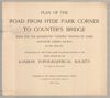
Plan of the road from Hyde Park Corner to Counter's Bridge
11 of 11