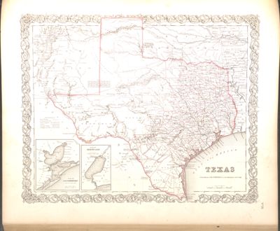
Shape of Texas
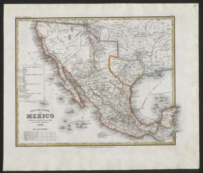
Everyone knows the shape of Texas. But across the centuries, vague geographic knowledge, differing languages, and contested borders produced maps showing a variety of shapes, including a stovepipe or a heart. Certain features — the Gulf of Mexico, the major rivers — are constant, and the eastern border along the Sabine River was established in the 1819 Adams-Onís Treaty, but the northern, southern, and western borders were long disputed.
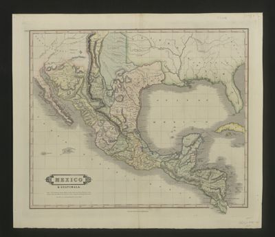
The territory known to us as Texas was explored and claimed by Spain but was not colonized right away. It was the threat of French occupation that prompted the Spanish to construct presidios and missions across the territory.
On December 19, 1836, the Congress of the Republic declared the boundaries of Texas to include the land between the sources of the Río Grande and the Arkansas River and from the Gulf of Mexico to the 42nd parallel, creating the distinctive “stovepipe.” While this impressive claim of territory was definitively settled by the Mexican-American War, it was reduced only a few years later. In the Compromise of 1850 Texas ceded territory in exchange for the federal government assuming Texas’s war debts; the Compromise also firmly established the border with New Mexico.
After 1850, the shape of Texas posed such issues for mapmakers that sometimes the Panhandle, other times the southern or western tips, are all too often removed and placed as insets elsewhere on the map sheet.