Exhibit Introduction
“Beginning at the mouth of the Sabine river, and running west along the Gulf of Mexico three leagues from land, to the mouth of the Rio Grande, thence up the principal stream of said river to its source, thence due north to the forty-second degree of north latitude, thence along the boundary line as defined in the treaty between the United States and Spain, to the beginning….”
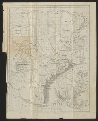
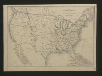
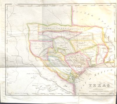
On December 19, 1836, the Congress of the Republic declared the boundaries of Texas. When that text is made into a map, the Republic of Texas includes the eastern half of New Mexico, a third of Colorado, and parts of Oklahoma, Kansas, and Wyoming—encompassing the land between the sources of the Río Grande and the Arkansas Rivers—and from the Gulf of Mexico to the 42nd parallel. It was an impressive claim of territory with borders settled by the Mexican-American War (1846-48); yet that territory was reduced only a few years later by the Compromise of 1850.
The maps in this exhibit document several centuries of exploration and political competition for one specific area of North America. With advancements in geographic knowledge, surveying techniques, and printing technology, one can begin to see Texas taking its now familiar form.
But land surveys and maps do not simply represent land. They are part of the method by which territory comes into being. Studies of surveying and cartography have become essential to the history of European colonization in the Americas. Maps were created to facilitate territorial expansion. They assisted colonization by claiming lands before they were occupied by the colonial powers, heedless of the indigenous population. By making its extensive land claims in 1836, the fledging Republic of Texas appropriated the Europeans’ own methods. And yet to Britain, Mexico, Spain, and to a degree France, Texas was crucial to keeping the expansionist United States in check. To Americans ever in search of land, Texas was the key to continental expansion.
Many of the books featured in this exhibit served to promote immigration to Texas, praising the rich, plentiful, and inexpensive land and the appealing climate. The books often included fold out maps, and more than a few noted the bison and horses that roamed the prairies, implying that cattle and other livestock would thrive. Others offered practical information for the would-be settlers on establishing themselves in Texas—how to claim land, location of settlements and roads, and other useful tips. Once the settler arrived in Texas, books and manuscripts provided guides to different property surveying methods with accompanying illustrations and tables that covered the geometric principles of surveying.
Anton duPlessis
Curator, Louise and Floyd Chapman
Texas & Borderlands Collection