Skip to search
Skip to main content
Texas A&M University Libraries
Help
Charting Texas
Home
About
Featured Areas
Shape of Texas
Immigration and Land Grants
Early Maps and Print
Tools, Techniques, and Methods
Browse
All exhibit items
57 items
All items in this exhibit.
« Previous
|
11
-
20
of
57
|
Next »
Number of results to display per page
10
per page
per page
10
per page
20
per page
50
per page
100
per page
View results as:
List
List
Gallery
Gallery
Created with Sketch.
Gallery
Search within this browse category
Clear search box
Highlight Off
Search within browse category
Search
11.
Karte von Texas, entworfen nach den Vermessungen welche in den Acten der General Land Office der Republic, liegen bis zum Jahr 1839
12.
Mapa de los Estados Unidos Mejicanos: arreglado a la distribucion que en diversos decretos ha hecho del territorio el Congreso General Mejicano
13.
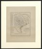
Texas: eine geographische Skizze bearbeitet nach Berghaus Länderkunde und den neuesten Forschungen des Prinzen Carl zu Solms Braunfels und anderer Reisenden
14.
Appletons' southern and western travellers' guide : with new and authentic maps, illustrating those divisions of the country, and containing sectional maps of the Mississippi and Ohio rivers, with plans of cities, views,etc...
15.
Map of the state of Texas: engraved to illustrate Mitchell's school and family geography
16.
The United States: and the relative position of the Oregon and Texas
17.
Galveston Bay and Texas Land Company
18.
Certification of land sale from John Houlihan, on the McMullen and McGloin colony, to Allen Hillway, of New Orleans, January 29, 1838
19.
Mexico, California and Texas
20.
Texas: observations, historical, geographical and descriptive : in a series of letters, written during a visit to Austin's colony, with a view to a permanent settlement in that country, in the Autumn of 1831
« Previous
Next »
1
2
3
4
5
6