Skip to search
Skip to main content
Skip to first result
Texas A&M University Libraries
Help
Charting Texas
A History of the State Through Maps
Home
About
Featured Areas
Shape of Texas
Immigration and Land Grants
Early Maps and Print
Tools, Techniques, and Methods
Browse
search for
Search
Search
Digital Collections
Home
Search results
Search
« Previous
|
41
-
50
of
57
|
Next »
Number of results to display per page
10
per page
per page
10
per page
20
per page
50
per page
100
per page
View results as:
List
List
Gallery
Gallery
Created with Sketch.
Gallery
Search Results
41.
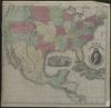
Map of the United States
42.
Hispania nova
43.
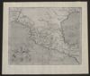
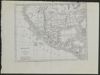
Mexico and Guatemala
44.
[Plan del presidio de San Sabá al de los Adaes y San Antonio de Véxar, comenzando desde el Nuevo Reino de Orleans demarcando todos los presidios, misiones, fuentes, pueblos y demás casas, de que se compone el ámbito de dicho mapa.]
45.
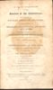
An account of expeditions to the sources of the Mississippi and through the western parts of Louisiana, to the sources of the Arkansaw, Kans, La Platte, and Pierre Jaun, rivers: performed by order of the government of the United States during the years 1805, 1806, and 1807...
46.
Topographical Map of the Road From Fort Smith, Arks. to Santa Fe, N.M. and from Donna Ana N.M. to Fort Smith: made by the order of Bvt. Grig Gen. M. Arbuckles, U.S.A. by Capt. R.B. Macy, 5th U.S. Inf.
47.
A new map of Mexico and adjacent provinces
48.
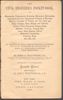
The civil engineers's pocket-book, of mensuration, trigonometry, surveying, hydraulics ... [etc.]: in addition to which the elucidation of certain important principles of construction is made in a more simple manner than heretofore
49.
Instructions for range surveys as formulated by the Inter-Agency Range Survey Committee and adopted by the Western Range Survey Conference, April 24, 1937
50.
Messico e Guatimala
« Previous
Next »
1
2
3
4
5
6